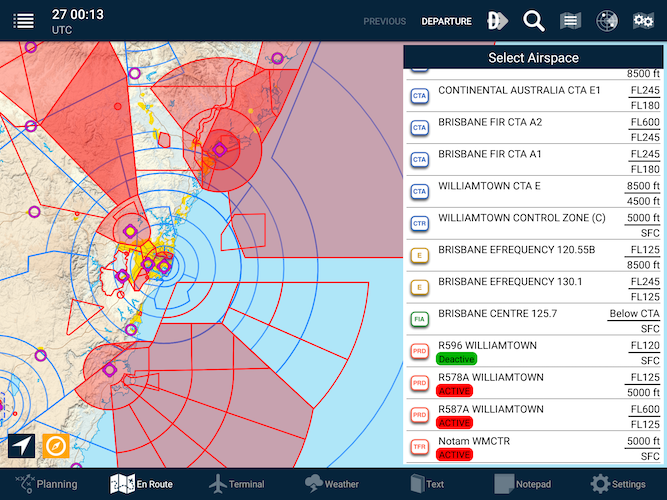
The status of Prohibited/Restricted/Danger airspace can be displayed on top of any map.
- Double-tap the map to display all airspace information above that point.
 Active airspace example
- All controlled airspace will be listed.
- The QNH Forecast region will be listed.
- The FIA and frequency can be found here.
- Any PRD areas.
- Any NOTAM notified airspace (such as Low Jet Routes, UAV operations, Parachute operations, etc)
| Airspace Colour Key | |
|---|---|
| Red | Airspace/NOTAM is active now |
| Yellow | Airspace/NOTAM is active in the future |
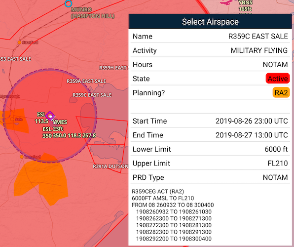
Viewing airspace information:
- Tap an entry in this list to highlight the boundaries on the map. Tap the devices’ back button to return to the list or dismiss the Select Airspace menu.
 Example of a selected airspace display
Need more help with this?
FAQs


