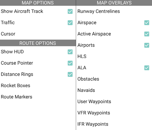
 Map Settings menu
- Map Overlays includes the following items to be overlaid on any map:
- Runway Centrelines
- Airspace boundaries
- Active Airspace (highlights region red on the map when PRD is active)
- Airports (Certified, registered or military airports)
- Helicopter Landing Sites (HLS)
- Authorised Landing Areas (ALA)
- Obstacles
- Navigation Aids
- User Waypoints
- VFR Waypoints
- IFR Waypoints
- Map Options includes:
- Show Aircraft Track toggles the visibility of the aircraft tracklog.
- Traffic toggles AvPlan Live traffic icons plotted on the map.
- Cursor adds a dot over the centre of the map view. The Lat/Long at the centre of the crosshair is displayed in real-time at the bottom of the screen.
- Route Options includes:
- Show HUD overlays live information about the current flight plan leg, current speed/course and ETA over the map.
- Course Pointer adds an animated course indicator to the aircraft, displaying anticipated position in 2, 5 and 10 minutes’ time (assuming groundspeed and track were to remain unchanged).
- Distance Rings toggles visibility of 3, 10 and 25 nautical mile rings around your current aircraft position.
- Rocket Boxes adds a brightly coloured box at the beginning of each leg containing the desired track and distance to the next waypoint.
- Route Markers. Coming soon!
Need more help with this?
FAQs


