
 En Route Weather Overlay menu
The Weather RADAR overlay displays a continuous loop of radar information for the last hour. The feed is refreshed every five minutes. Note: this may lag actual rain by up to approximately 5-10 minutes.
 Winter weather- it was not a flying day in the melbourne basin
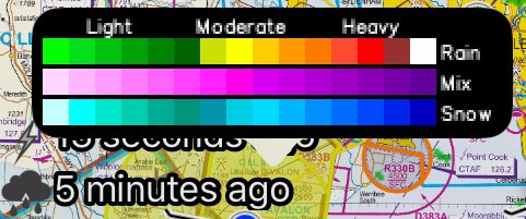
The colour of the weather radar overlay is almost intuitively obvious, but not quite:
Shades of green mean rain, yellow means heavier rain, orange means heavy rain, red means very heavy rain, black means what you think- the heaviest and quite likely dangerously heavy rain. Blue means quiet rain, otherwise known as snow.
Animated overlays such as this can be played in a loop, paused or stepped forwards/backwards, using the icons on the radar controls.

These controls appear at the bottom of the map page.
The timestamp for the snapshot is displayed in the bottom-left hand corner. 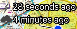
You can also select from:
- Infrared Satellite (cloud)
- Surface Pressure Forecast
- Freezing Level Forecast
- Mid level SIGWX
- High Level SIGWX
- Australian Echo Tops Forecast
The Mid level SIGWX Forecast, High Level SIGWX Forecast and Australian Echo Tops Forecast are Plus/Premium features.
A guide to interpretation of SIGWX charts is available from the Australian Bureau of meteorology.
Overlay Legend
To view a legend/key for the weather radar overlay, tap on the update time (in the bottom-left corner of the EnRoute tab).
Need more help with this?
Help Centre (Tap and hold to open the Link)