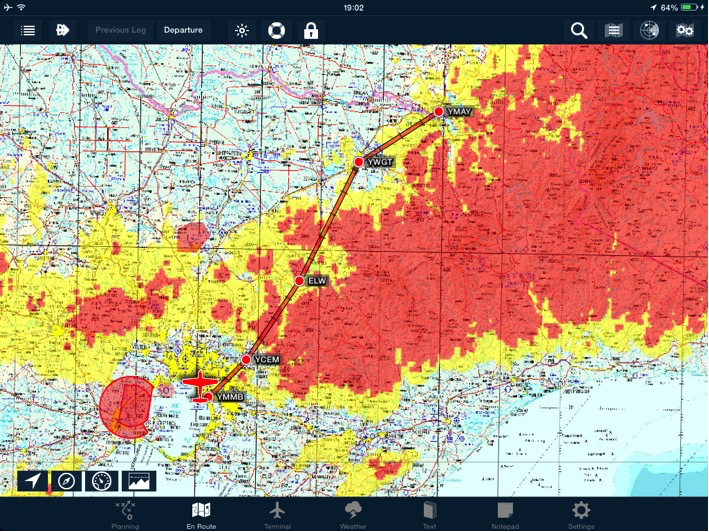
A terrain overlay can be added to all mega maps.
 Terrain overlay
The overlay operates in two distinct modes:
Plan Mode
When the flight plan is in Plan mode, the terrain overlay colour codes the terrain based on the highest cruise altitude in your flight plan.
Fly Mode
When in Fly mode, the terrain overlay colour codes the terrain based on the current altitude. In flight, the terrain overlay will update every 150 foot vertical change during climb or descent.
Colour Codes
| Yellow | Terrain that is 1500 feet below to 500 feet below you |
|---|---|
| Red | Terrain that extends from 500 feet below to above you |
Need more help with this?
Help Centre (Tap and hold to open the Link)


