The AvPlan Live traffic system
The AvPlan Live traffic system allows you to see other connected airborne AvPlan EFB users and a multitude of traffic from a network of ADS-B and FLARM ground receivers.
Requirements to see AvPlan Live traffic:
- To see any traffic other than that being sourced from a local ADSB receiver.
- AvPlan Live Tracking must be turned on in Settings
- Your device must be connected to a data network; either via WiFi or 4G/5G
- And in any case,
- Your device must have a valid GPS position
The Traffic Display
This is turned on or off in map Options

When traffic is switched on, AvPlan EFB displays traffic symbols on any selected map.
Due to data network limitations, displayed traffic is limited to a radius of ~ 180 nautical miles and ±15,000 feet from your devices’ current GPS position, and is updated at five second intervals.
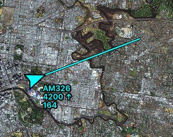
 Traffic example
Traffic targets are accompanied with an information block, with three possible rows of information:
- Callsign
- GPS height in feet, with a climb/descent arrow symbol
 Aircraft on climb Aircraft on climb |
 Aircraft on descent Aircraft on descent |
- Groundspeed in knots
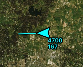
If no callsign is available, only two rows will be displayed:
- GPS height in feet, with a climb/descent arrow symbol
- Groundspeed in knots
No callsign example
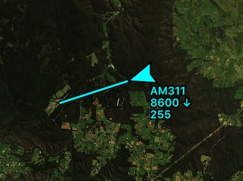
Extending out the front of each target, is the one minute future position prediction line. Assuming the aircraft does not change heading or speed, the aircraft will be at the end of the line in one minute. Aircraft travelling at high speeds (e.g. jet or turboprop traffic) will have longer lines than those of slower GA traffic.
 Traffic examples with differing groundspeed
Traffic sources
The traffic displayed on EnRoute maps is provided via the AvPlan servers from more than one source, and is blended into a single view. Where a traffic target is available from more than one source, the source with the highest refresh rate (generally ADS-B from a connected device) will take precedence, while the other/s will be hidden from view.
Note that one of the external sources is the Open Glider Network (OGN), so gliders equipped with FLARM that are within ground-based FLARM receiver range and registered with the OGN will also display. (The requirement for the glider to be within ground-based receiver range may be a significant limitation for gliders undertaking long cross country tasks- you probably won’t see them).
Zooming in for details
Double tapping a traffic target will zoom that icon and its details, as well as showing a trail of its recent history. This will be in the form of a cyan line trailing from the aircraft. If the source is an AvPlan user and they have elected to share their flight plan (see AvPlan Live Tracking in the Settings tab), you will also see the remainder of the plan ahead of the aircraft in purple.
Double tapping again will shrink it back to normal size.
If you zoom the whole en-route (map) pane, the traffic icons will not change size until you reach a preset level of zoom, after which all of the traffic icons will zoom.
External Device traffic
When AvPlan EFB is connected to an ADS-B receiver, traffic out to as far as the receiver can observe will be displayed. Traffic sourced from the receiver will be coloured green to allow quick identification of a traffic target’s source. No height or distance limitations are placed on traffic delivered by an attached device.
Traffic received via this method is updated once every second.

To read more about the kinds of compatible devices that AvPlan EFB can connect to, visit our AvPlan Omni page.
Need more help with this?
Help Centre (Tap and hold to open the Link)


