Native inclusion of Windy.com provides an elegant animated visualisation of winds aloft. While this site is not an official source of aviation wind information, it serves as an excellent visual supplement to the officially-sourced wind data.
 Windy interface
Tap on the map to view a sample of the wind at that position.
Use the timeline slider at the bottom of the screen to project forward in time.

The planned cruise altitude from your flight plan (or the closest level within Windy) will automatically be selected. If no flight plan is open, 2000ft AMSL is selected by default.
If you wish to change the altitude at which to visualise, tap the Wind icon in the lower-right of the window.
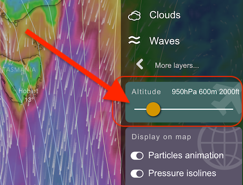
Half way down the menu list that pops up you’ll see an altitude slider. Move it right or left to select a different level.
 Windy altitude slider
If the page does not load properly, you can use the refresh button 
Need more help with this?
Help Centre (Tap and hold to open the Link)


