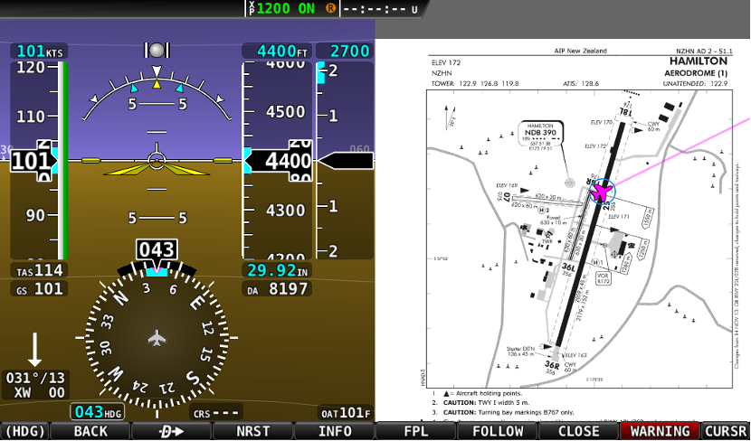
To display the airfield charts (Plates), follow the steps detailed below.
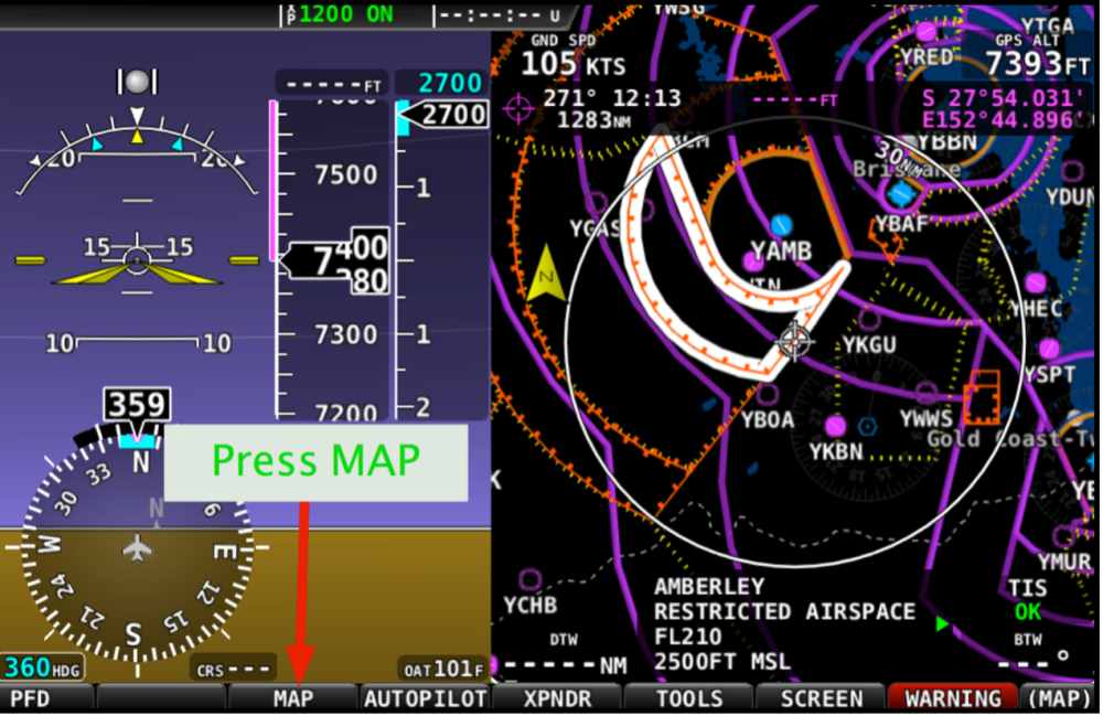
MAP Options
Firstly, press the MAP button to reveal the MAP options
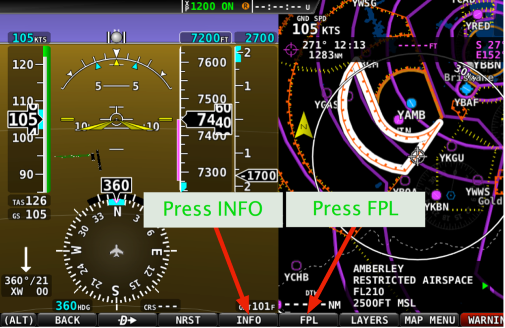
FPL or INFO Options
On the MAP screen press either the FPL (& then INFO on next screen) or the MAP screen INFO button to reveal the current navigation point details.
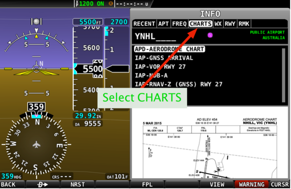
Use the joystick dial to move the cursor from RECENT to CHARTS to display the plate for the airfield. If a plate is available the aerodrome chart will be displayed under the list of charts available for the airfield.
If you would like to replace the MEGA VFR map with the chart, press the VIEW button on the INFO display. The map view will be replaced with the selected chart. Also, if the aircraft location is currently located on the airfield being displayed, your aircrafts location will be displayed on the chart by the Dynon device.